Dealing with land subsidence
Many deltas and coastal areas in the world not only need to deal with rising sea levels but also with land subsidence. The societal costs of subsidence are huge. In urban areas, subsidence causes serious damage to infrastructure, buildings and landscapes. In rural areas, it can lead to salt intrusion and the oxidation of peat areas causes considerable emission of greenhouse gases. Since subsidence is caused by human activities such as drainage and the extraction of groundwater or gas, we also have the tools to limit and counteract this physical process. Deltares is therefore conducting research in the Netherlands and abroad, to answer questions such as 'why is the land subsiding', 'how much more will it subside', 'how can we use this knowledge for policy implementation and governance issues' and 'how can we limit land subsidence'?
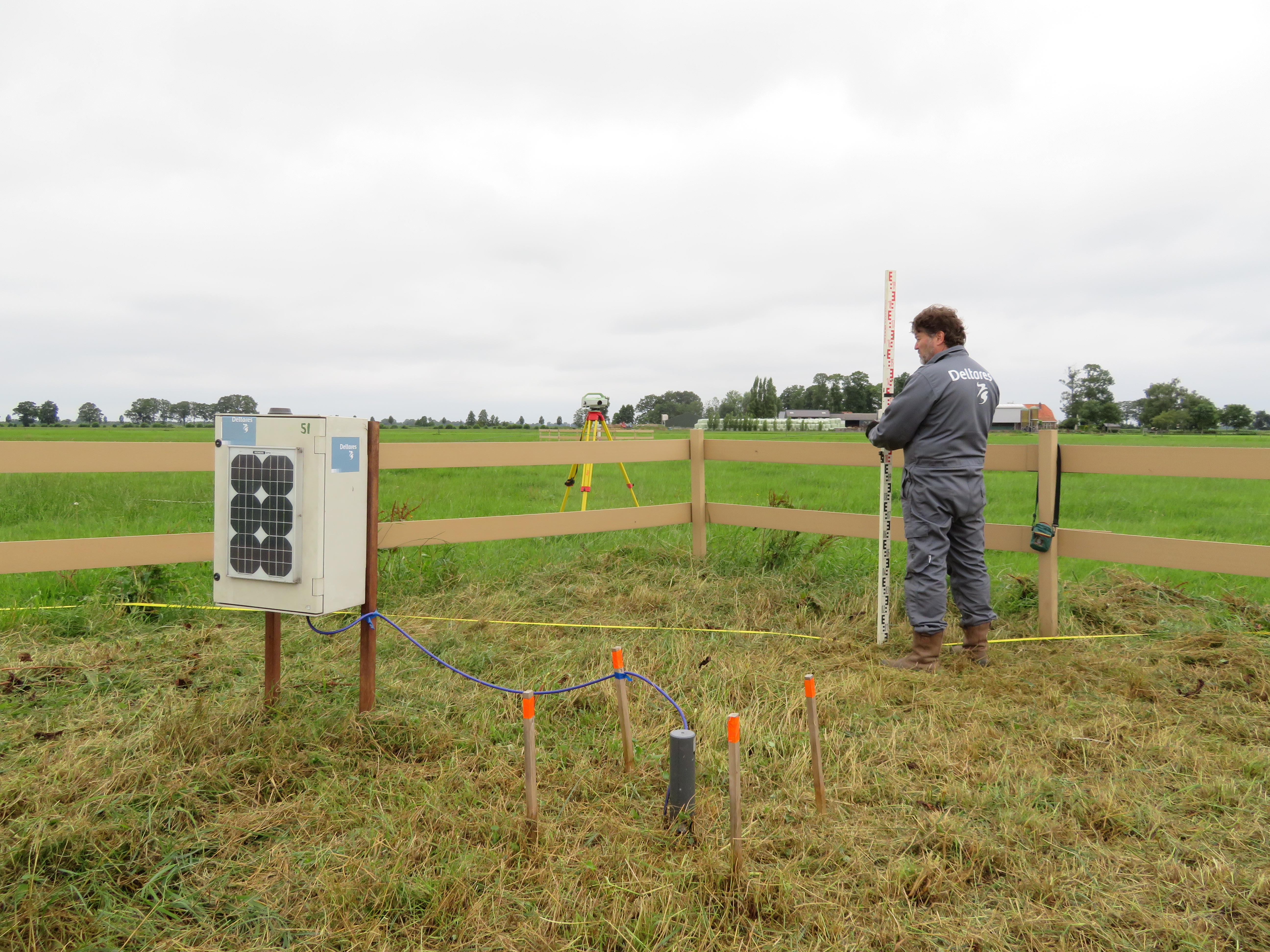
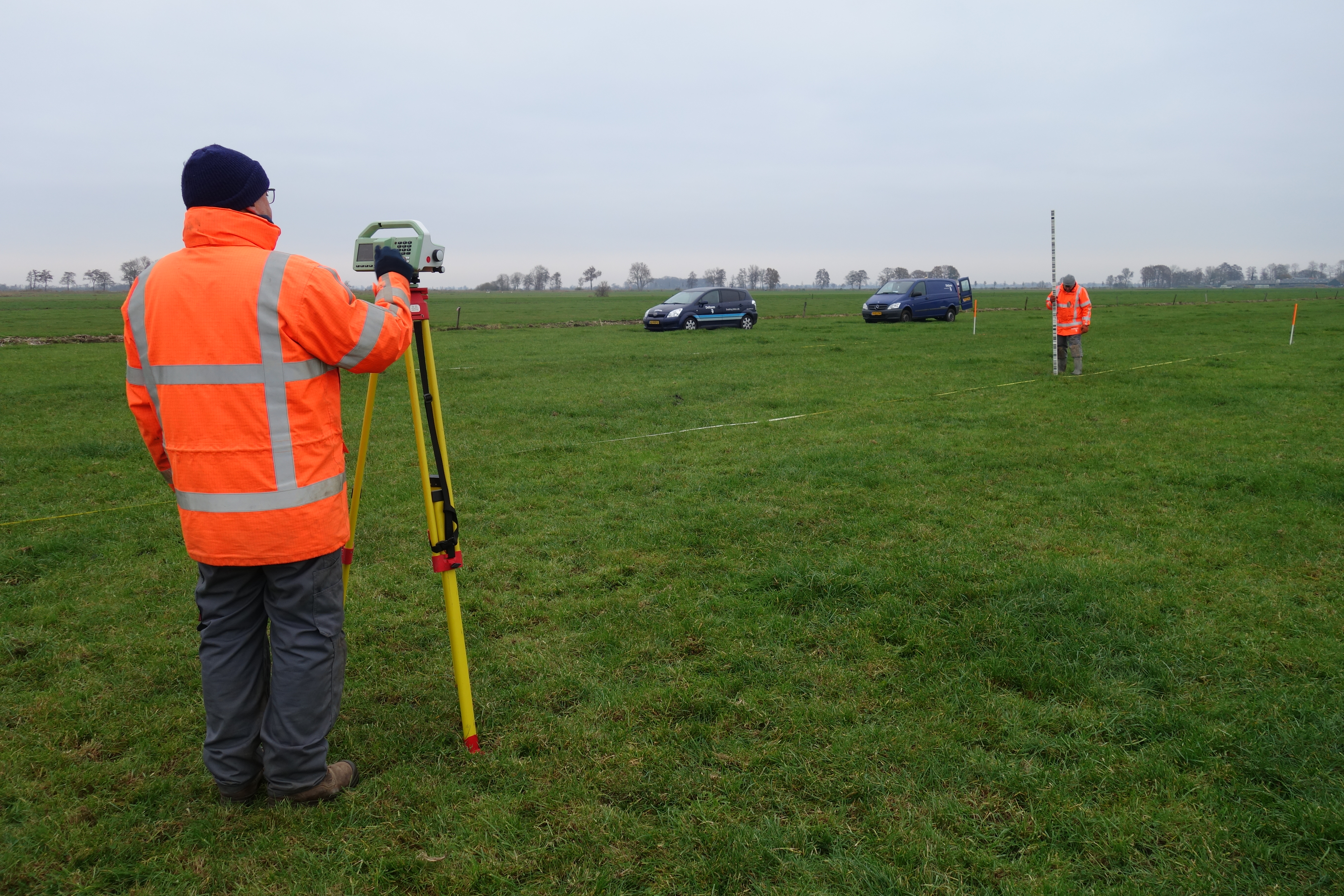
Measuring land subsidence and greenhouse gas emissions in The Netherlands
The land subsidence research project 'Region Deal subsidence Groene Hart' and the ‘National Research Programme Greenhouse Gases Peat Meadow Area’ give a boost to the measurements of subsidence in the Netherlands. Together with research partners, Deltares has set up monitoring sites at various locations in Dutch peatlands to structurally and frequently measure land subsidence. An example of these measurements are the “Supersized soil samples”. Based on measurements, we can now start to unravel the key mechanisms that cause land subsidence. This information is necessary to come up with effective technical solutions and policy measures to limit subsidence and reduce the societal costs. For example, provinces will use the model predictions and advice from these research projects to update their policies, to realize their ambitions to decrease subsidence by 70% in 2050 and the greenhouse gas emission to neutral by 2050.
'We want to measure subsidence just as seriously and structurally as sea level rise, so that we can learn from the good examples and mistakes of the past and determine the right approach for each area'
Gilles Erkens, subsidence expert at Deltares
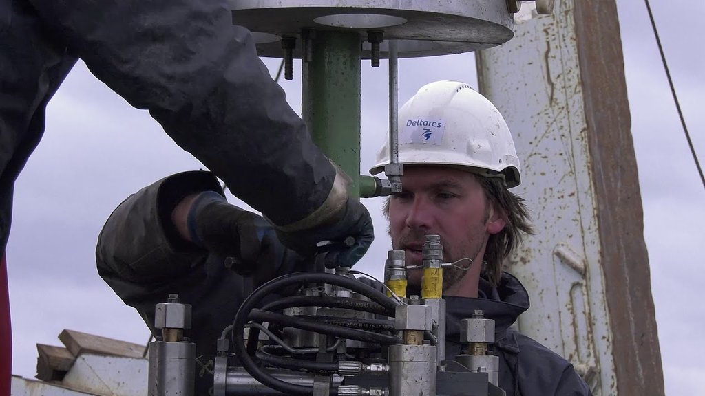
Supersized soil samples
Supersized soil samples are taken at the peat meadow test site with the aim of predicting the extent of land subsidence due to the compression of peat. The samples, which have a diameter of 40 cm, can be used to determine the geotechnical properties of the peat such as its compressibility, density, and amounts of organic matter and carbon. These geotechnical properties are used as input for land subsidence models.
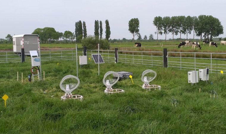
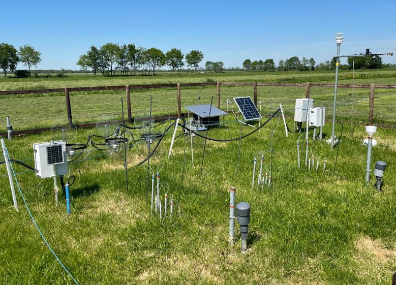
Measuring set-ups
Various measuring set-ups measure CO2 emissions and soil movements via an extensometer. Besides these measurements we also do field experiments to determine the geotechnical properties. Beyond that, we focus on modelling on different spatial scales and make economic impact calculations.
Sharing knowledge on subsidence with policy-makers
With the data from monitoring sites, we can understand the processes and mechanisms of land subsidence better. Deltares uses this knowledge to improve models for predictions. The results are used in the new maps in the Climate Effect Atlas to forecast land subsidence. These forecasts provide insight into the extent of subsidence in the Netherlands until 2100. The open-source land subsidence forecast maps provide users with all the relevant information down to the city level. As such, the maps are used by policy-makers who make decisions that may affect land subsidence. The Province of South Holland, for instance, uses the subsidence forecast map in their Climate stress test and Climate adaptation strategy.
'The rate of land subsidence caused by human activity can be changed and the maps show that'
Gilles Erkens, subsidence expert at Deltares
Supporting municipalities in dealing with subsidence
Deltares supports municipalities in applying knowledge on subsidence to solve the challenges they face in that field. For the city of Amsterdam, Deltares performed a quick scan on the economic impact of subsidence in their municipality. Deltares also worked with the city of Gouda for several years, to support them in designing an action plan for the sinking city centre.
Realizing impact
Various measuring set-ups measure CO2 emissions and soil movements via an extensometer. Besides these measurements we also do field experiments to determine the geotechnical properties. Beyond that, we focus on modelling on different spatial scales and make economic impact calculations.

Working according to the 6 M's
Our research is organized around six aspects that are important when making policy for dealing with land subsidence.
- It starts with Measuring: determining how much the soil is subsiding. Deltares is building soil subsidence measurement systems at various locations in the Netherlands and abroad.
- On the basis of these Measurements, it is then possible to unravel the main mechanisms that cause soil subsidence. Only when we know which mechanisms are responsible for soil subsidence effective measures can be designed. In this way, Deltares contributes to the development of a broad knowledge base about the various processes that lead to subsidence.
- Models are used to map how much subsidence can be expected in the future.
- Money: Social cost-benefit analyses are used to map the action perspective. Deltares provides the information that makes it possible to translate the level of subsidence into the social costs that this results in.
- Deltares provides insight into the possible Measures to be taken. This involves both technical and policy measures.
- Finally, it is important to Monitor the effectiveness of the measures. Only in this way can we learn from good examples and from past mistakes.
1. Measuring
2. Understanding Mechanisms
4. Money (CBA)
3. Predictive Modelling
5. Implementation of Measures
6. Monitoring and evaluation
6M
Tackling land subsidence (in Dutch; English subtitles)


View SDGs


View Dutch missions

It starts with Measuring: determining how much the soil is subsiding. Deltares is building soil subsidence measurement systems at various locations in the Netherlands and abroad.
On the basis of these Measurements, it is then possible to unravel the main mechanisms that cause soil subsidence. Only when we know which mechanisms are responsible for soil subsidence effective measures can be designed. In this way, Deltares contributes to the development of a broad knowledge base about the various processes that lead to subsidence.
Models are used to map how much subsidence can be expected in the future.
Money: Social cost-benefit analyses are used to map the action perspective. Deltares provides the information that makes it possible to translate the level of subsidence into the social costs that this results in.
Deltares provides insight into the possible Measures to be taken. This involves both technical and policy measures.
Finally, it is important to Monitor the effectiveness of the measures. Only in this way can we learn from good examples and from past mistakes.