
San Francisco Bay-Delta estuary
Improving water quality and ecosystems
To gain better insights into San Fransisco Bay’s water quality and ecosystem, Deltares – together with the United States Geological Survey (USGS) – is developing computational models. The models are open-source, allowing other scientists and policymakers to easily expand and use the tools in other case studies.

San Francisco Bay challenges
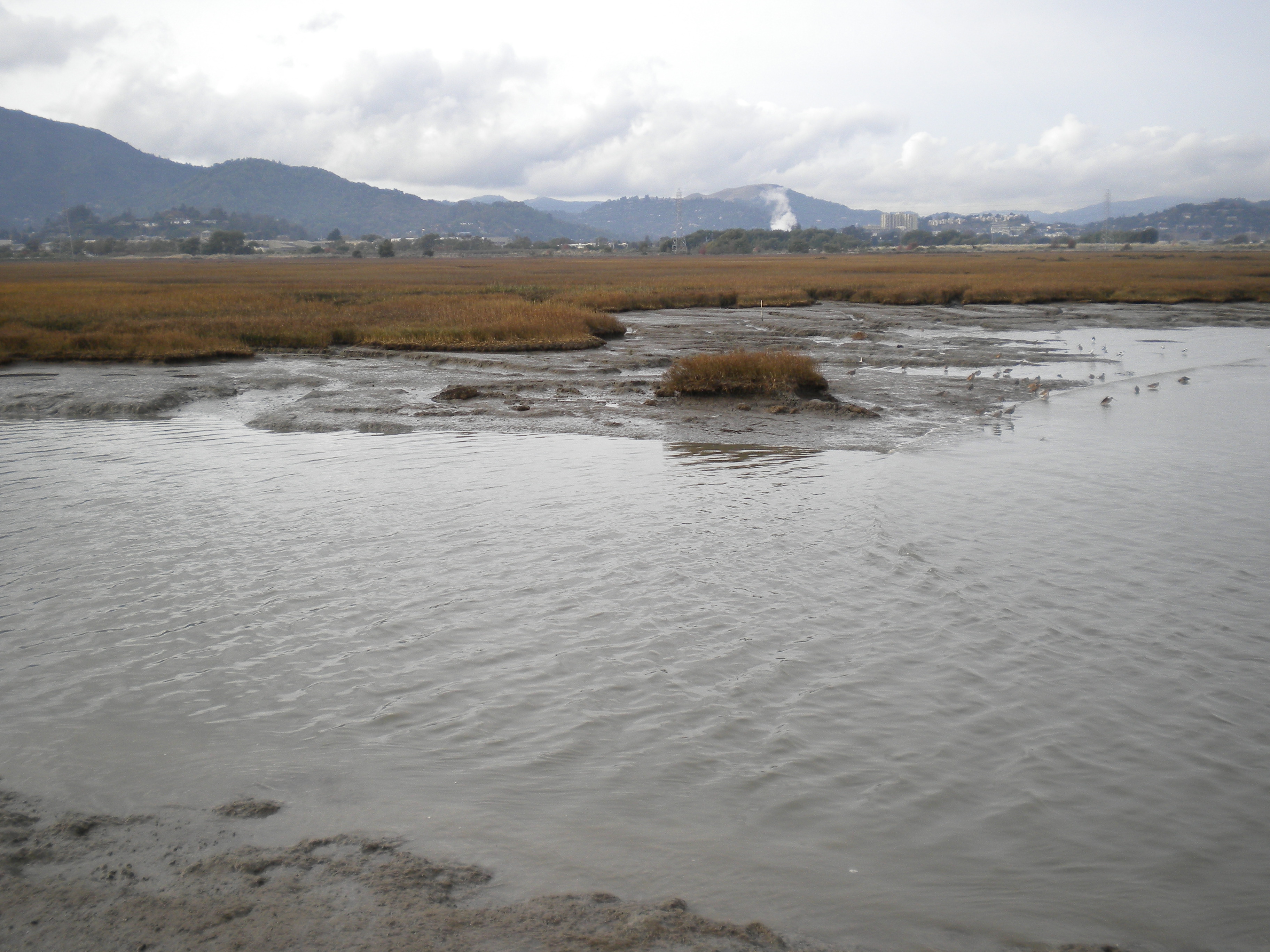
The San Francisco Bay-Delta system in California is the largest estuary (a widened river mouth, where fresh river water and salt seawater mix) on the US West Coast. It is home to salt marshes and native species of birds and fish. At the same time, the area is densely populated and connected to an area of intensive agriculture. The Bay-Delta provides two-thirds of California's drinking water. The ecosystem in the estuary has long been under pressure. Salt intrusion and flooding have a significant impact on the environment. Rising sea levels and chances of major earthquakes threaten hundreds of kilometers of levees. If the system fails to continue providing ecological services and freshwater supplies, the consequences are potentially disastrous for all of California.


Driving innovations
Deltares has been working with the USGS, the scientific agency of the United States Department of the Interior, for years on managing water quality and ecosystems in the San Francisco Bay-Delta. ‘The models and software we are developing with the USGS are open source and can therefore be used by anyone,’ says Mick van der Wegen, researcher at Deltares.
‘An important advantage of open source is that it allows you to drive innovation; it’s not just software that benefits, but also society. Based on the knowledge you share, you can communicate more easily and efficiently. The specific questions that arise from other users allow us to expand our models. The Bay-Delta model is an example of this.

Wetter becomes even wetter
Kees Nederhoff is a coastal researcher at Deltares USA and works extensively with Mick and Lisa Lucas (USGS) from the San Francisco Bay for coastal development and flood resilience projects around the world.
Kees points out that California's weather has been changing in recent years: wetter becomes even wetter, whilst periods of drought last longer. Last winter, records were broken with the largest amount of rainfall ever recorded. ‘It is interesting to see how strongly our computational systems respond to this kind of extreme data. Today, we have more information and computing power to more quickly and concretely process the information.’
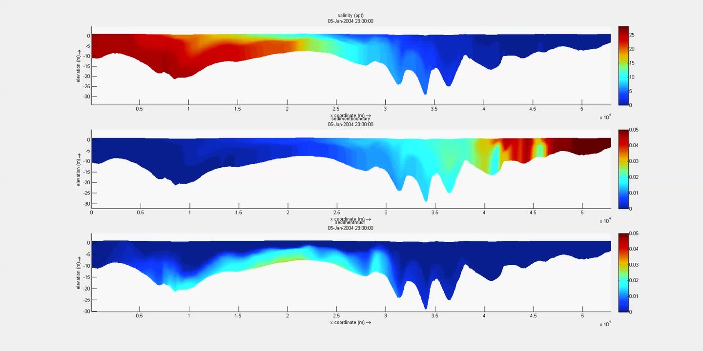
The top panel shows the intrusion of salt water along a 50-km cross-section of the San Francisco North Bay during different tidal cycles. At one point, the freshwater inflow increases dramatically due to increased river flow, which pushes the saltwater back seaward. The middle and bottom panels show the associated dynamics of fine sediment coming from the river and the bay.
Better understanding complex systems
Lisa Lucas is a research general engineer at USGS Water Resources Mission Area. Within the CASCaDE project, she focused on complex models for water quality and ecosystems.
‘We can never predict exactly what will happen to the Bay-Delta system in the future. However, we do want a better and more accurate understanding of how these complex ecosystems...
Read the story
Better understanding complex systems
Lisa Lucas is a research general engineer at USGS Water Resources Mission Area. Within the CASCaDE project, she focused on complex models for water quality and ecosystems.
‘We can never predict exactly what will happen to the Bay-Delta system in the future. However, we do want a better and more accurate understanding of how these complex ecosystems currently work. Once we have this, we can rig possible future water management or other scenarios until the end of the twenty-first century,’ Lisa explains. ‘For example, we want to be able to better understand how the ecosystem might respond to different events in the future, such as climate change, salt intrusion, new water infrastructure, dike breach, and possible ecosystem restoration.’
This requires integrated tools to model and analyze data. ‘With the software that Deltares is building, we create models that predict changes in the ecosystem. They also indicate what effect those changes have on water quality.’
It served as one of the first validated showcases of our Delft3D FM software. We were able to show how future scenarios resulting from climate change or human interventions affect the hydrodynamics, sediment dynamics, and water quality of the San Francisco Bay-Delta. Data collected by USGS over the years was used by Deltares for model validation. The result is unique in the world. Both organizations are jointly participating and investing in this ongoing project. In doing so, they are jointly establishing a co-creation project that can grow further and become available to third parties.’ Van der Wegen explains; ‘We are currently working on software that calculates backwards in time. If you measure a pollutant somewhere, for example untreated sewage, you want to know the origin. You measure a concentration somewhere and you can go back in time to find out where that came from. This is very useful, also for Dutch applications.’
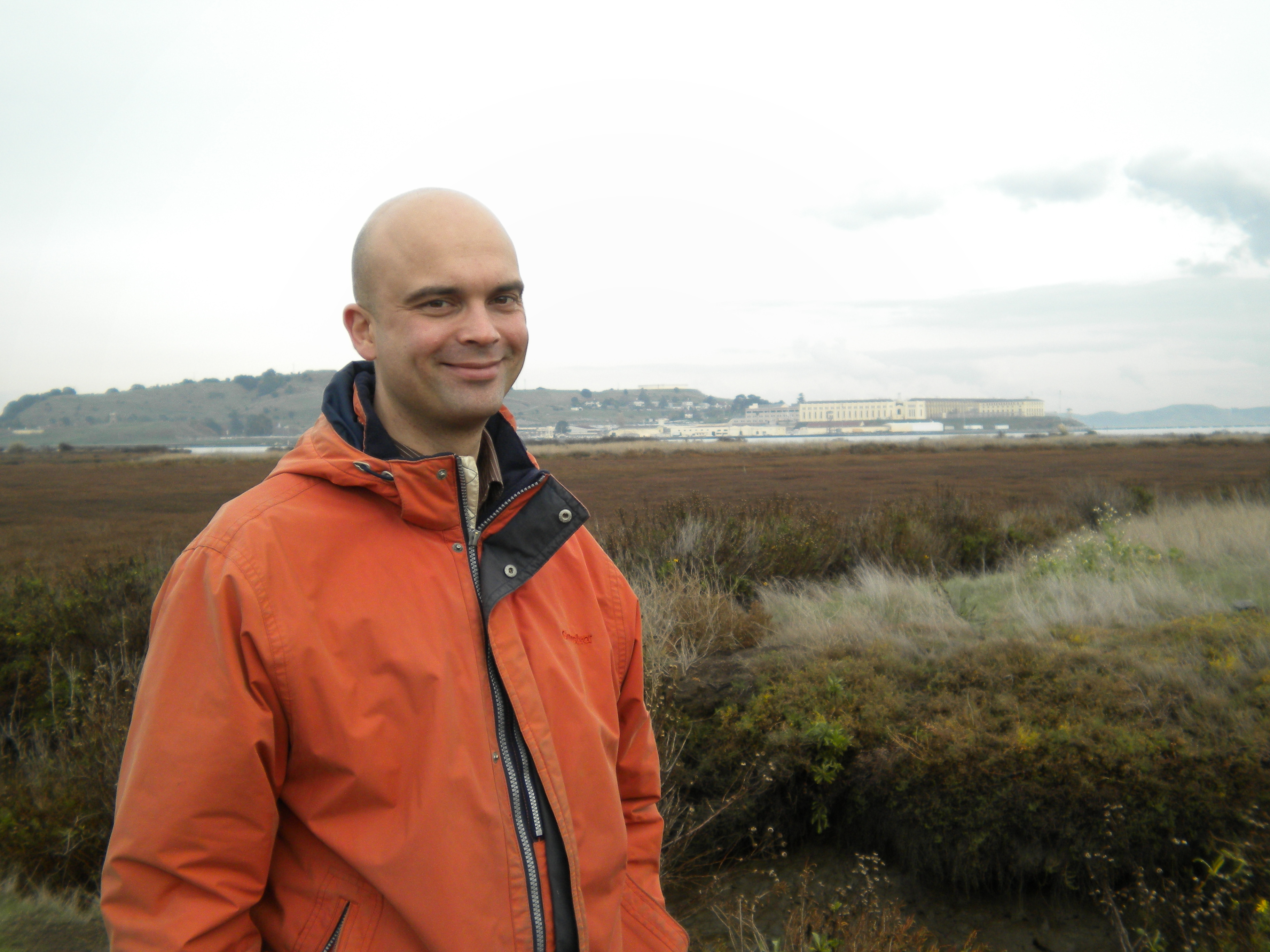
Mick van der Wegen
Expert estuariene dynamics Deltares


